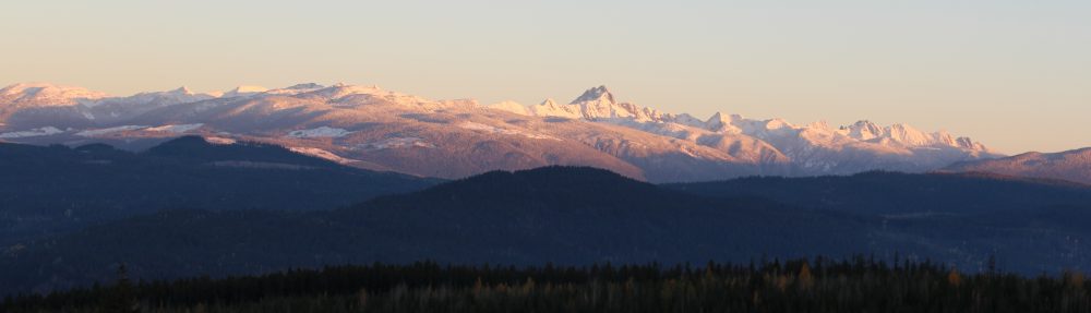
The Lower North Thompson Community Forest Society would like to acknowledge that we live, work, and play on the traditional, ancestral, and unceded territory of Simpcw First Nation. We would also like to thank and acknowledge Simpcw’s foundational role in helping us secure our Community Forest Agreement. Chu Chua is one of several local communities in the Lower North Thompson Valley that our Society seeks to serve.
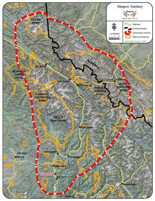
The Lower North Thompson Community Forest Society’s main license area is shown below in red. It can be accessed in three ways:
East of Barriere along Barriere Lakes Road then the South Lake FSR
or
East of Barriere along Barriere Lakes Road then the East Lake FSR
or
South of Barriere along Agate Bay Road then the Minova and Dixon FSR’s

Biogeoclimatic Ecosystem Classification (BEC)
The Community Forest is currently situated in the Interior Cedar Hemlock (ICH) and the Interior Douglas-fir (IDF) Biogeoclimatic zones. Ecosystem classification relies on information about the topography, climate, soils, and plant species growing in specific regions – using these indicators one can determine which subzone they are in. To learn more about the BC’s Biogeoclimatic (BEC) system click here.
The main tree species in the ICH are:
- Western redcedar (Thuja plicata)
- western hemlock (Tsuga heterophylla)
- Paper Birch (Betula papyifera)
- Douglas-fir (Pseudotsuga menziesii)
- hybrid spruce (Picea engelmannii x glauca)
- Trembling Aspen (Populus tremuloides)
- lodgepole pine (Pinus contorta)
The ICH zone is dubbed the “Interior Rain forest” and is the most productive zone in the interior with very good species diversity.
The main tree species found in the IDF are:
- Douglas-fir (Pseudotsuga menziesii)
- hybrid spruce (Picea engelmannii x glauca)
- western white pine (Pinus monticola)
- lodgepole pine (Pinus contorta)
- Trembling Aspen (Populus tremuloides)
- lodgepole pine (Pinus contorta)
The IDF is most notably identified by the various grass species in the understory. This is the second warmest forest zone in interior BC. Important mule deer winter range habitats are found within these areas of the province. Denser Douglas-fir-dominated forests provide snow interception and thermal insulation allowing for easier forage and mobility within the landscape.
At higher elevations, the ICH zones transition into the Engelmann Spruce-Subalpine Fir (ESSF) zone. Other tree species that occur in the Community forest include Ponderosa pine (Pinus ponderosa), western white pine (Pinus monticola), rocky mountain juniper (Juniperus scopulorum), and Black cottonwood (Populus trichocarpa). To learn more about BC’s tree species click here.
The maps below were created using the web version of the ClimateBC model created by the Center for Forest Conservation Genetics (CFCG) based out of UBC.
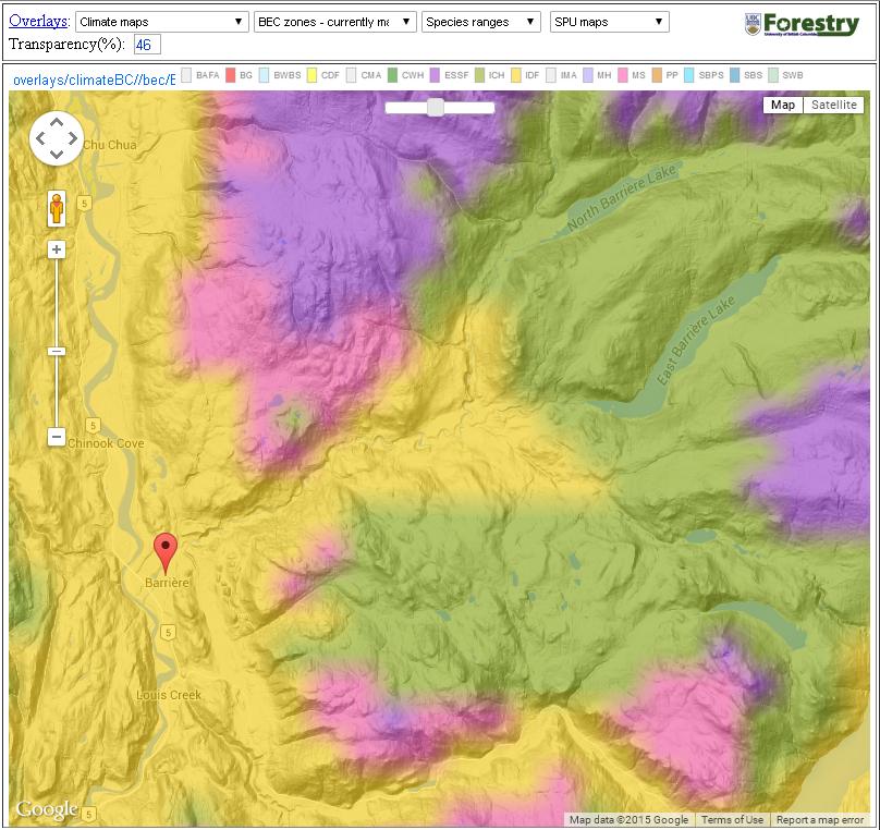
Current BEC Zones (Source: ClimateBC) Colour code: ICH = green, IDF = yellow, MS = pink, ESSF = purple
Climate Change and the Community Forest
Using the models provided in ClimateBC, a projection can be made for what the climate could be like in the future and therefore where the associated BEC zone may shift. The map below shows the projection for 2050 in the LNTCFS area. The prediction shows an increase in the area classified as IDF with the ICH moving up in elevation and decreasing in area. This is due to predictions that indicate increases in mean annual temperature and decreases in mean annual precipitation.

Projected BEC Zones 2050 (Source: ClimateBC) Colour code: IDF = yellow, ICH = green, ESSF = purple, MS = pink, PP = orange
